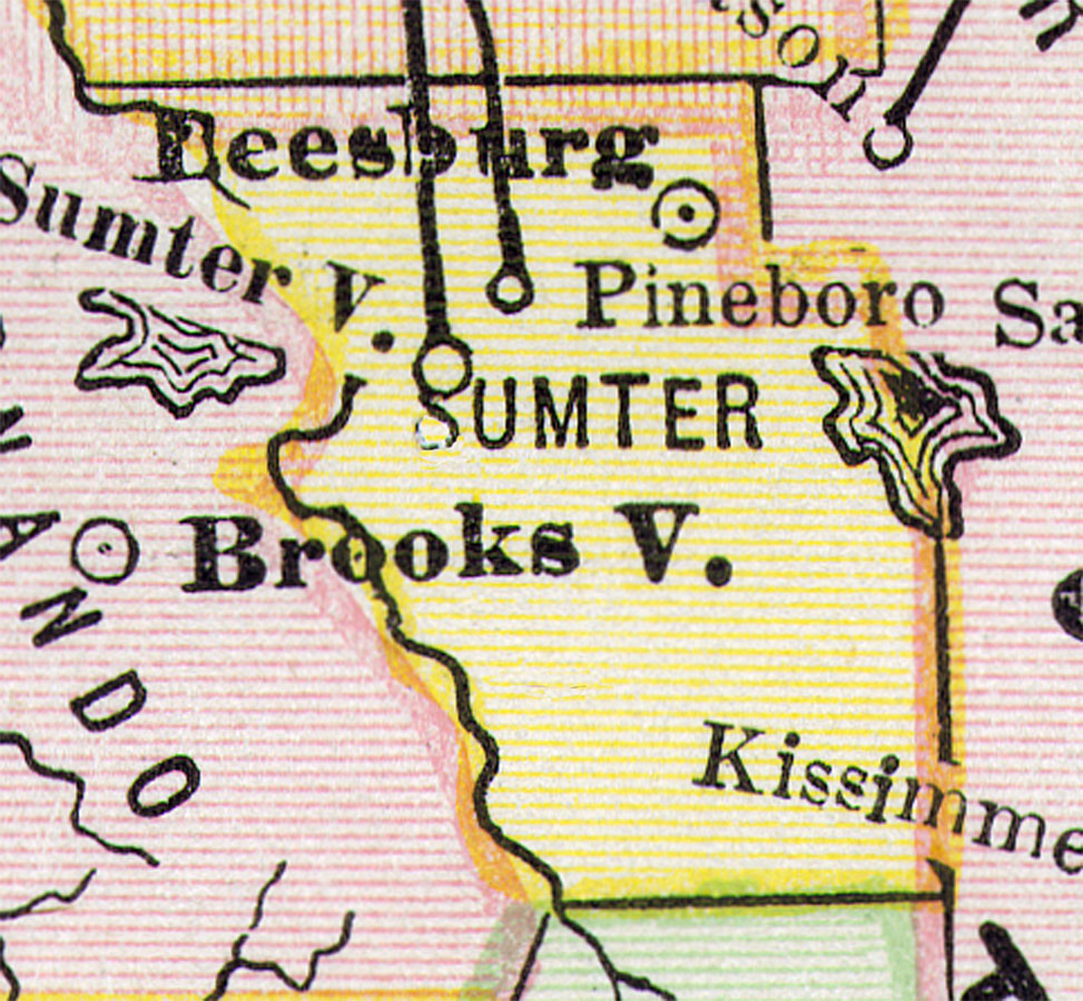
Description: Digitization provided by the USF Libraries Digitization Center. This Sumter County map is from PoorŐs railroad map of Florida, circa 1883. It shows railroads, counties and county seats, cities and towns and inland waters. Approximate map scale is 75 miles to 1 inch. This particular map shows Sumter County extending into what is now Lake County. Leesburg is shown as the County Seat. Two railroad lines extend into Sumter County from Marion County south to Sumterville and Pineboro.
Place Names: Sumter, Leesburg, Pineboro, Sumterville
ISO Topic Categories: inlandWaters, transportation, boundaries
Keywords: Sumter County, political, transportation, county borders, railroads, inlandWaters, transportation, boundaries, Unknown,1883 AD
Source: Henry Varnum Poor, compiler, Poor's manual of railroads 1883: Manual of the railroads of the United States (Chicago, IL: Rand McNally and Company, 1883)
Map Credit: Courtesy of the Special Collections Department, University of South Florida. |
|