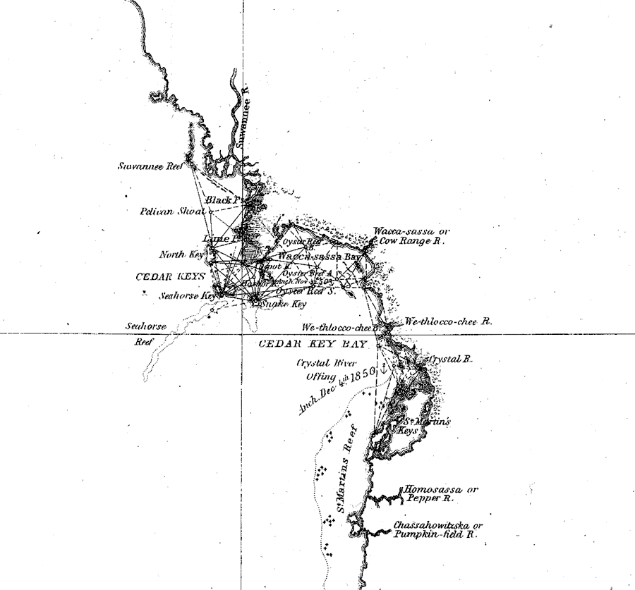
Description: A portion of a U.S. Coast Survey chart showing the Cedar Keys from the Suwannee Reef in the north to the Chassahowitzka or Pumpkin-field River in the south on the west coast of Florida. The chart includes sailing directions including bearings, soundings and detailed triangulations. The map also shows the mouth of the Suwannee River, the Wacca-sassa or Cow Range River, the We-thlocoo-chee River, Crystal River, and the Homosassa or Pepper River. Surveyed by F. H. Gerdes. The mapscale is 1:1,200,000.
Place Names: 1840-1859, Cedar Key, Suwannee Reef, Seahorse Key, Chassahowitzka River, Crystal River
ISO Topic Categories: transportation
Keywords: Cedar Keys: A General Reconnoissance of the Western Coast of Florida, physical, transportation, physical features, water routes, transportation, Unknown,1851
Source: F.H. Gerdes, U.S. Coast Survey (Washington, DC: Government Printing Office, 1851)
Map Credit: Courtesy the private collection of Roy Winkelman |
|