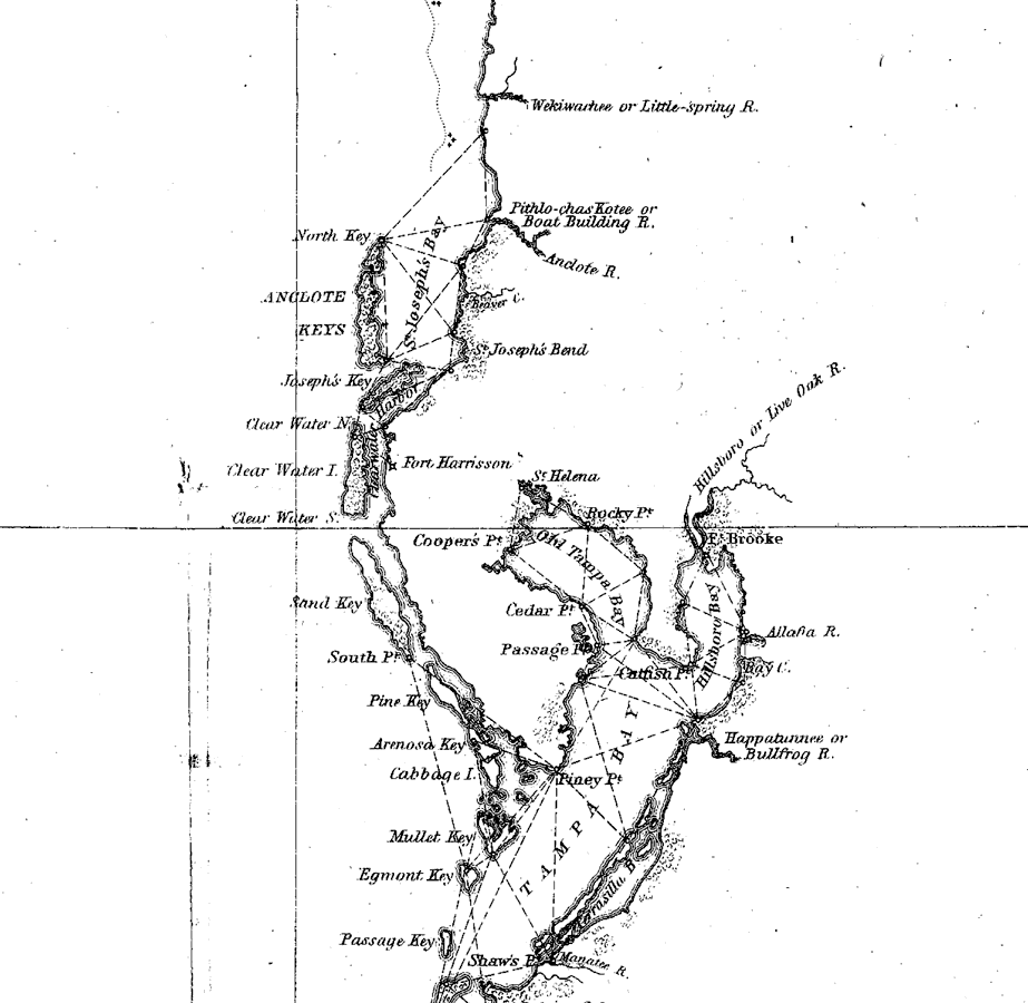
Description: A portion of a U.S. Coast Survey chart showing the area around Tampa Bay on the west coast of Florida from Anclote Key in the north to Piney Bluff at the south end of Sarasota Bay in the south. The chart includes sailing directions including bearings, soundings and detailed triangulations. The map also shows the mouth of the Wekiwachee or Little-spring River, the Pithlo-chas Kote or Boat Building River, the Hillsborough or Live Oak River, and the Happatunnee or Bullfrog River. The barrier island system from Anclote Key south to Egmont, Anna Maria, and Long keys is shown. Included is an in-land notation describing dense forest of cypress and pine broken by tracts of prairie and swamp. Surveyed by F. H. Gerdes. The map scale is 1:1,200,000.
Place Names: 1840-1859, Anclote Key, Clear Water Island, Fort Harrison, Piney Point, Egmont Key, Tampa Bay, Old Tampa Bay, Fort Brooke,Sarasota Bay, Anna Maria Key
ISO Topic Categories: transportation
Keywords: Tampa Bay: A General Reconnoissance of the Western Coast of Florida, physical, transportation, physical features, water routes, transportation, Unknown,1851
Source: F.H. Gerdes, U.S. Coast Survey (Washington, DC: Government Printing Office, 1851)
Map Credit: Courtesy the private collection of Roy Winkelman |
|