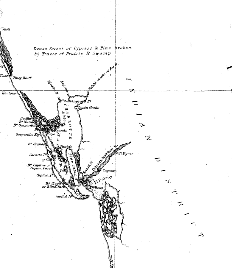
Description: A portion of a U.S. Coast Survey chart showing the area around Charlotte Harbor on the west coast of Florida from north of Gasparilla Key to Oyster Bay (Estero Bay) in the south. The chart includes sailing directions including bearings, soundings and detailed triangulations. The map also shows the mouth of the Myakka River, Talahk-chopko or Peace River, and Caloosa-hatchee River. Included is an in-land notation describing dense forest of cypress and pine broken by tracts of prairie and swamp. Surveyed by F. H. Gerdes. The map scale is 1:1,200,000.
Place Names: 1840-1859, Charlotte Harbor, Punta Gorda, Fort Myres, Fort Delany, Sanibel Island, Fort Casey
ISO Topic Categories: transportation
Keywords: Charlotte Harbor: A General Reconnoissance of the Western Coast of Florida, physical, transportation, physical features, water routes, transportation, Unknown,1851
Source: F.H. Gerdes, U.S. Coast Survey (Washington, DC: Government Printing Office, 1851)
Map Credit: Courtesy the private collection of Roy Winkelman |
|