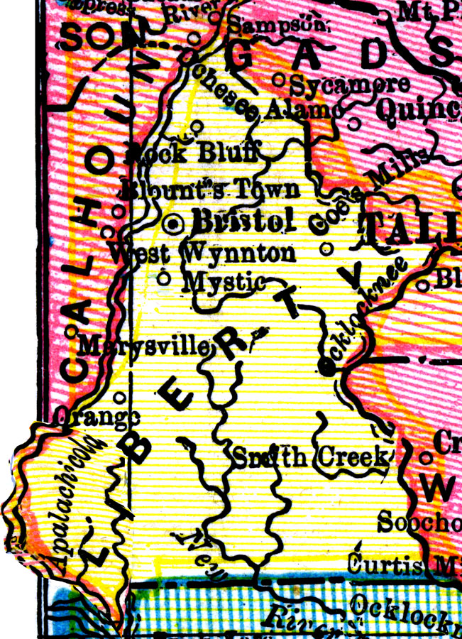
Description: A map of Liberty County as of 1898 showing rivers, towns, and the county seat, Bristol.
Place Names: Liberty, Orange, Mystic, Bristol, Rock Bluff
ISO Topic Categories: boundaries, inlandWaters
Keywords: Liberty County, physical, political, physical features, county borders, boundaries, inlandWaters, Unknown,1898
Source: George Franklin Cram, Cram's Universal Atlas: Geographical, Astronomical, and Historical (Chicago, IL: Geo. F. Cram, 1898)
Map Credit: Courtesy the private collection of Roy Winkelman. |
|