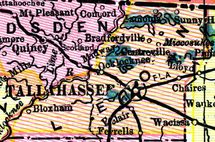
Description: A map of Leon County as of 1898 showing rivers, lakes, railroads, towns, and the state capital, Tallahassee.
Place Names: Leon, Tallahassee, Chaires, Miccosukee, Lamonia, Sunny Hill, Bradfordville, Bloxham, Bellair
ISO Topic Categories: boundaries, inlandWaters, transportation
Keywords: Leon County, physical, political, transportation, capitals, physical features, county borders, major political subdivisions, railroads, boundaries, inlandWaters, transportation, Unknown,1898
Source: George Franklin Cram, Cram's Universal Atlas: Geographical, Astronomical, and Historical (Chicago, IL: Geo. F. Cram, 1898)
Map Credit: Courtesy the private collection of Roy Winkelman. |
|