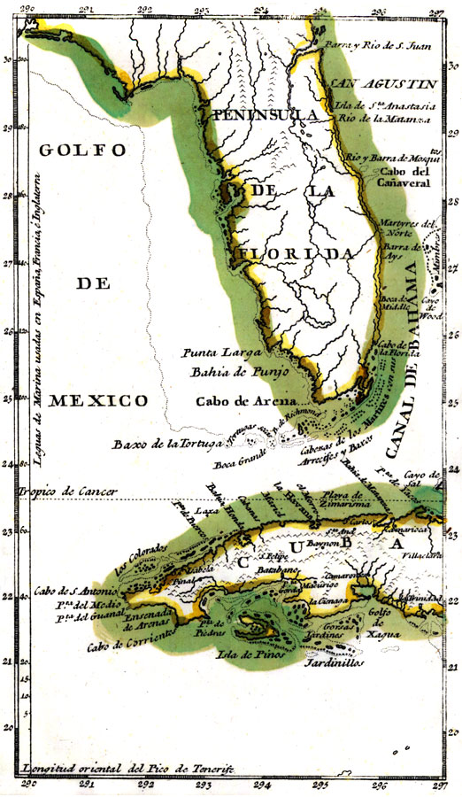
Description: Digitization provided by the USF Libraries Digitization Center. Rare Maps. This is a map of Florida including west Cuba showing inland waters and towns in Spanish, circa 1783. It is an inset map from a hand colored map of the Saint Augustine region. It shows the location of Saint Augustine or San Agustin, Cape Canaveral or Cabo del Canaveral, and more. [ca. 1:7,000,000].
Place Names: 1780-1799, San Agustin, Saint Augustine, Rio de la Matanza, Matanzas River, Golfo de Mexico, Gulf of Mexico, Cuba, Cabo del Canaveral, Cape Canaveral, Isla de Santa Anastasia, Anastasia Island, Boca Grande, Dry Tortugas, Baxo de la Tortuga
ISO Topic Categories: inlandWaters, oceans
Keywords: Florida, physical, historical, political, physical features, inlandWaters, oceans, Unknown,1783
Source: Don Tomas Lopez, (Madrid, 1783)
Map Credit: Courtesy of the Special Collections Department, University of South Florida. |
|