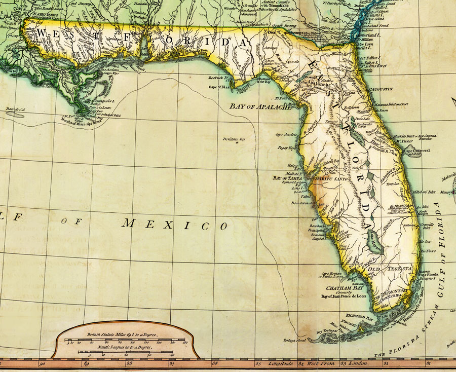
Description: Digitization provided by the USF Libraries Digitization Center. Rare Maps. This is a map of Florida divided into West and East Florida, circa 1794. It is a portion of the map of the Southern Dominions belonging to the United States of America. It shows country borders, cities and towns such as St. Augustine, railroads, and inland waters such as Lake Mayaco or Lake Okeechobee. Relief shown pictorially. British statutes miles 69 1/2 to a degree. Nautical Leagues 20 to a degree.
Place Names: 1780-1799, West Florida, East Florida, Gulf of Mexico, Gulf of Florida, St. Augustin, Saint Augustine, Pensacola, Tampa Bay, Bay of Espiritu Santo, Cape Canaveral, Fort Picolata, Lake George, Lake Mayaco, Lake Okeechobee, Cape Sable
ISO Topic Categories: boundaries, inlandWaters, oceans, transportation
Keywords: Detail of Florida from A New and General Map of the Southern Dominions Belonging to the United States of America, physical, political, transportation, historical, physical features, country borders, roads, boundaries, inlandWaters, oceans, transportation, Unknown,1794
Source: Robert Laurie and James Whittle, (London, : Robert Laurie and James Whittle Publishers, 1794)
Map Credit: Courtesy of the Special Collections Department, University of South Florida. |
|