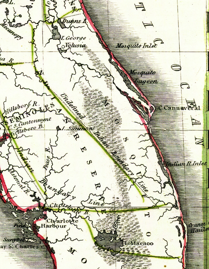
Description: Digitization provided by the USF Libraries Digitization Center. Rare Maps. This is a map of Mosquito County, circa 1830. It is a portion of Rand McNally and Co.'s new business map of Florida. It shows county boundaries, unidentified Indian boundary lines, cities such as Cape Canaveral, inland waters such as Lake Macaco or Lake Okeechobee, etc.
Place Names: Mosquito, Cape Canaveral, Atlantic Ocean, Lake Macaco, Lake Okeechobee, Seminole Indian Reserve, Charlotte Harbor, Mecanopy, Micanopy, Volusia, Cape Cannaveral, Indian River Inlet
ISO Topic Categories: inlandWaters, oceans, boundaries
Keywords: Mosquito County, Florida, historical, physical, political, physical features, county borders, inlandWaters, oceans, boundaries, Unknown,1830
Source: Joseph Meyer, Rand McNally and Co.'s new business map of Florida (and) Rand McNally and Co.'s indexed atlas of the world (Philadelphia, PA: Rand McNally and Co., 1830)
Map Credit: Courtesy of the Special Collections Department, University of South Florida. |
|