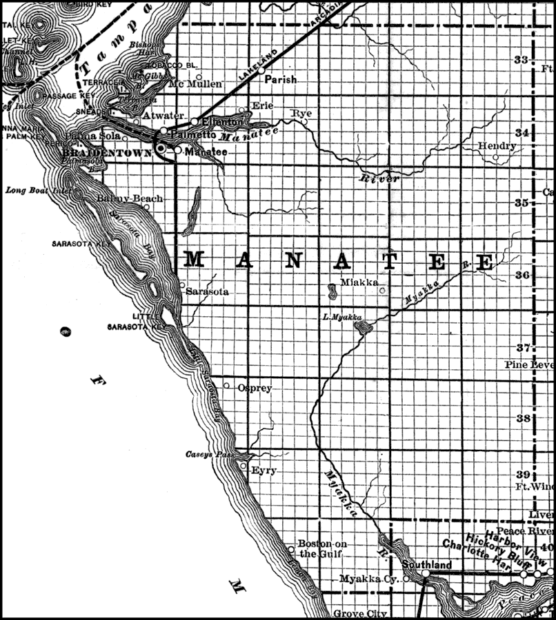
Description: A portion of Schrader's 1891 phosphate map of central Florida showing Manatee County. Digitization provided by the USF Libraries Digitization Center. Rare Maps. This is a map of Manatee, Polk, Lee and Hillsborough counties circa 1891. It shows phosphate plants in these counties that are in operation (letters) and those that are in the process or in contemplation (digits). Section Township Range (STR) is shown.
Place Names: Manatee, Boston on the Gulf, Braidentown, Anna Maria, Bradenton, Palmetto, Erie, Ellenton, Parish, Rye, McMullen, Manatee, Sarasota, Myakka City
ISO Topic Categories: transportation, boundaries, inlandWaters, oceans, economy
Keywords: Phosphate Plants of Manatee County, historical, transportation, political, statistical, mining, physical, physical features, county borders, railroads, transportation, boundaries, inlandWaters, oceans, economy, Unknown,1891
Source: Jay Shrader, Hidden treasures: the pebble phosphates of the Peace River Valley of South Florida (Bartow, FL: Varn and Varn, 1891)
Map Credit: Courtesy of the Special Collections Department, University of South Florida. |
|