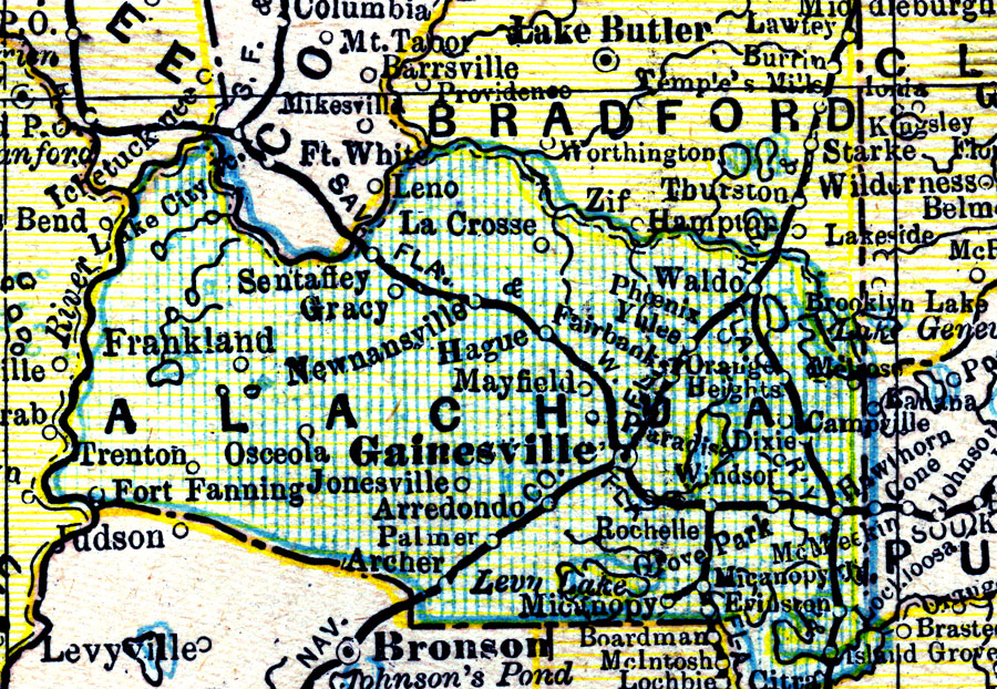
Description: A map of Alachua County showing towns, bodies of water, county lines, the county seat (Gainesville), and railroads connecting the major cities current to 1890.
Place Names: Alachua, Sentaffey, Gracy, Newnansville, Ft. Fanning, Trenton, Frankland, Arrendondo, Archer, Micanopy, Rochelle, Gainsville, Waldo , Hawthorne
ISO Topic Categories: boundaries, inlandWaters, transportation
Keywords: Alachua County, physical, political, transportation, physical features, county borders, railroads, boundaries, inlandWaters, transportation, Unknown,1890
Source: George F. Cram, (Chicago, IL: Geo. F. Cram, 1890) 47
Map Credit: Courtesy the private collection of Roy Winkelman. |
|