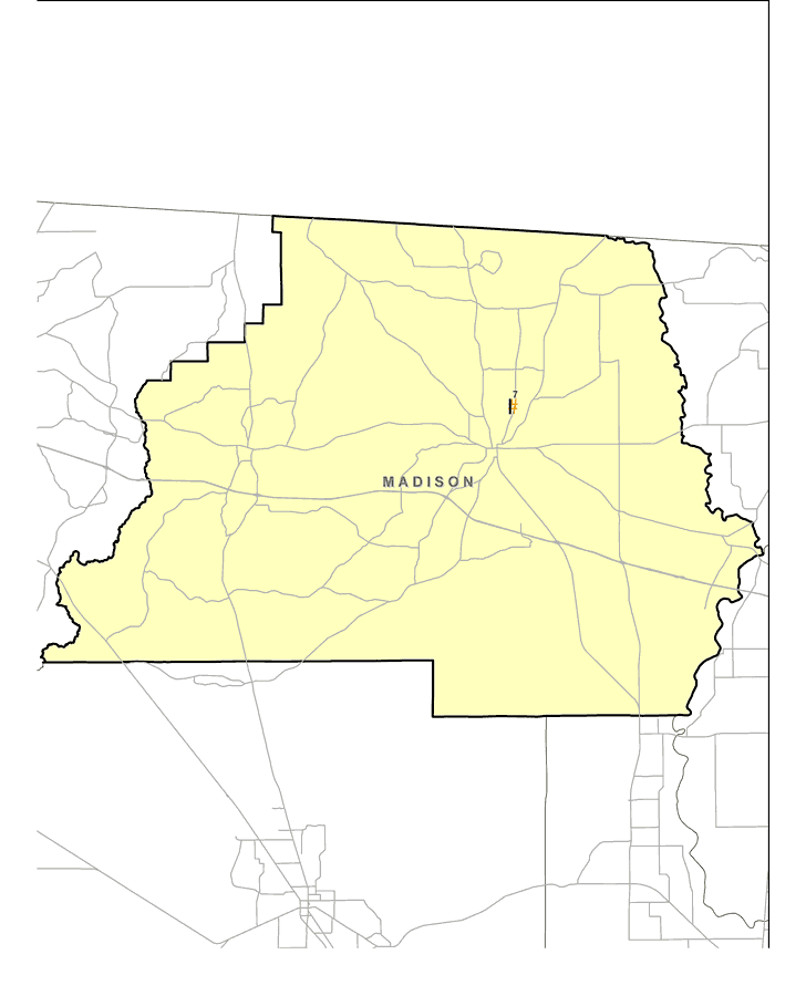
Description: This map shows the location of Madison County's Superfund Site listed on the United States Environmental Protection Agency's National Priorities List (NPL). The map was created based on Environmental Protection Agency (EPA) shapefiles and metadata. Full information about each site, including each site history, narrative, and Agency for Toxic Substances and Disease Registry (ATSDR) information can be found on the U.S. EPA website. The site name, latitude/longitude, and NPL status for the Madison site is:| 7 | Madison County Sanitary Landfill
Rocky Ford/Jestlamb Sch. Rd. Jct.
Madison, FL 32340 | NPL: On final NPL
Latitude: 30.501111
Longitude: -83.39375 |
Place Names: Madison, Madison
ISO Topic Categories: environment, health, inlandWaters, society
Keywords: Madison EPA Superfund Sites, physical, political, Hazardous Waste Sitephysical features, county borders, environment, health, inlandWaters, society, Albers_Conical_Equal,2008
Source: Florida Center for Instructional Technology, (Tampa, FL: FCIT, 2008)
Map Credit: Courtesy Roy Winkelman |
|