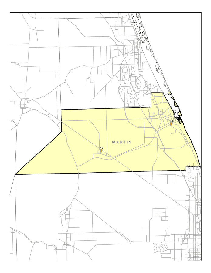
Description: This map shows the locations of Martin County's two Superfund Sites listed on the United States Environmental Protection Agency's National Priorities List (NPL). The map was created based on Environmental Protection Agency (EPA) shapefiles and metadata. Full information about each site, including each site history, narrative, and Agency for Toxic Substances and Disease Registry (ATSDR) information can be found on the U.S. EPA website. The site name, latitude/longitude, and NPL status for the Martin sites are:| 48 | Solitron Microwave
4100 Cove Road
Port Salerno, FL 34997 | NPL: On final NPL
Latitude: 27.136667
Longitude: -80.199167 | | 49 | Florida Steel Corp.
S. R. 710
Indiantown, FL 33956 | NPL: On final NPL
Latitude: 27.041111
Longitude: -80.506111 |
Place Names: Martin, Salerno, Indiantown
ISO Topic Categories: environment, health, inlandWaters, society
Keywords: Martin EPA Superfund Sites, physical, political, Hazardous Waste Sitephysical features, county borders, environment, health, inlandWaters, society, Albers_Conical_Equal,2008
Source: Florida Center for Instructional Technology, (Tampa, FL: FCIT, 2008)
Map Credit: Courtesy Roy Winkelman |
|