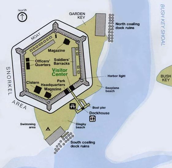
Description: A detail map of Fort Jefferson in the Dry Tortugas National Park. The map shows the Park Visitor Center within the fort, various historical structures within the fort, and campsites, swimming and snorkeling areas, boat pier, and seaplane beach.
Place Names: Monroe, Garden Key, Bush Key, Fort Jefferson
ISO Topic Categories: boundaries, structure
Keywords: Detail of Fort Jefferson, Dry Tortugas National Park, physical, hydrological, physical features, boundaries, structure, Unknown,1994
Source: National Park Service
Map Credit: Courtesy of the National Park Service |
|