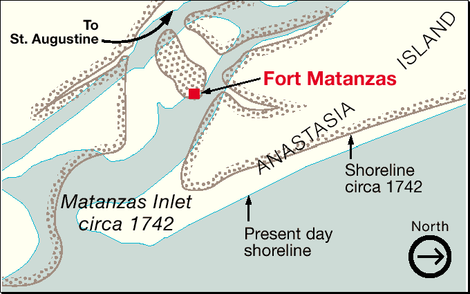
Description: This map, adapted from a National Park Service map, shows the present day coastline around Matanzas Inlet and Anastasia Island and the coastline circa 1742. The map show the strategic location of Fort Matanzas at the mouth of the inlet, guarding the approach to St. Augustine. This map is oriented with north to the right.
Place Names: St. Johns, Fort Matanzas, Anastasia Island
ISO Topic Categories: boundaries, inlandWaters
Keywords: Map of Fort Matanzas, physical, transportation, physical features, water routes, boundaries, inlandWaters, Unknown,1742
Source: FCIT, (Tampa, FL: Florida Center for Instructional Technology, 2006)
Map Credit: Courtesy of FCIT |
|