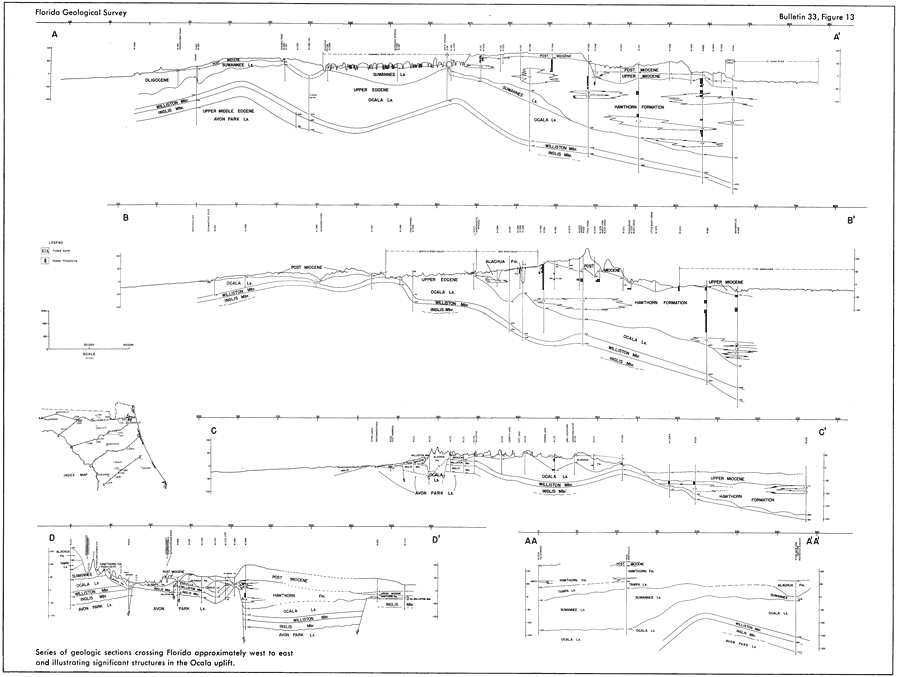
Description: This map from the Florida Geological Survey Bulletin number 33, shows 5 geologic sections crossing the northern Florida Peninsula approximately west to east and illustrating significant structures in the Ocala uplift. The map shows locations of Miocene, Oligocene, and Eocene formations including Suwannee, Ocala, and Avon Park limestones, the Hawthorn Formation, as well as Williston and Inglis members.
Place Names: 1950-1999, Citrus County, Levy County
ISO Topic Categories: boundaries, geoscientificInformation
Keywords: Geologic Sections Crossing the Northern Portion of the Florida Peninsula, physical, political, kgeology, physical features, geological, major political subdivisions, boundaries, geoscientificInformation, Unknown,1951
Source: Robert O. Vernon, Geology of Citrus and Levy Counties, Florida (Tallahassee, FL: The Florida Geological Survey, 1951) 54
Map Credit: Courtesy the private collection of Roy Winkelman |
|