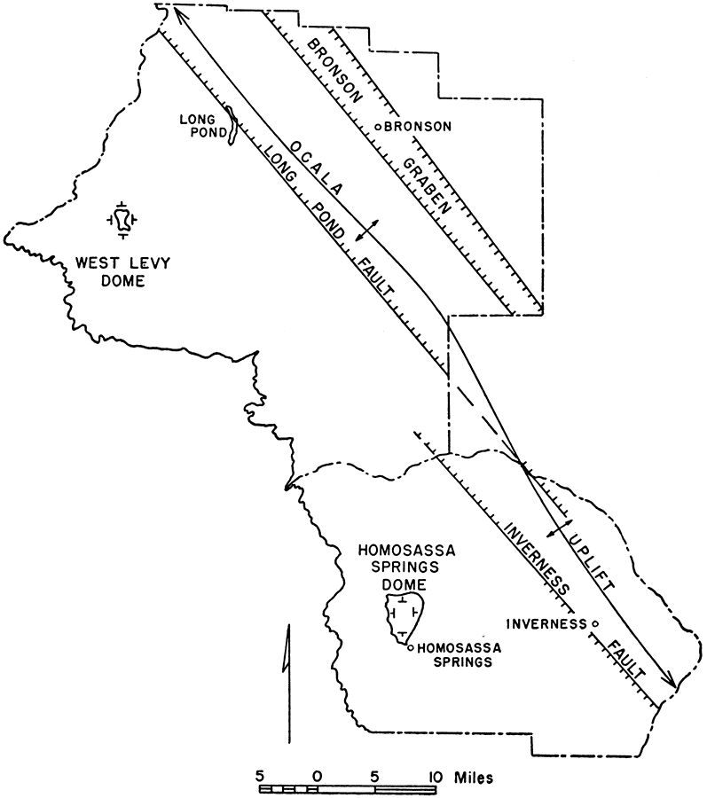
Description: This map from the Florida Geological Survey Bulletin number 33, shows the principal geologic structures within Citrus and Levy counties. These counties are situated on the crest of a broad, elongated arch known as the Ocala uplift. Along the uplift run horst-graben normal faults, including the Long Pond fault, the Inverness fault, and the Bronson graben. In the western section of the map, two small, sharply raised domes are indicated by annular outcrop bands. These are the West Levy dome and the Homosassa Springs dome.
Place Names: 1950-1999, Citrus County, Levy County
ISO Topic Categories: boundaries, geoscientificInformation
Keywords: Principal Geologic Structures in Citrus and Levy Counties, physical, political, kgeololy, physical features, geological, county borders, boundaries, geoscientificInformation, Unknown,1951
Source: Robert O. Vernon, Geology of Citrus and Levy Counties, Florida (Tallahassee, FL: The Florida Geological Survey, 1951) 59
Map Credit: Courtesy the private collection of Roy Winkelman |
|