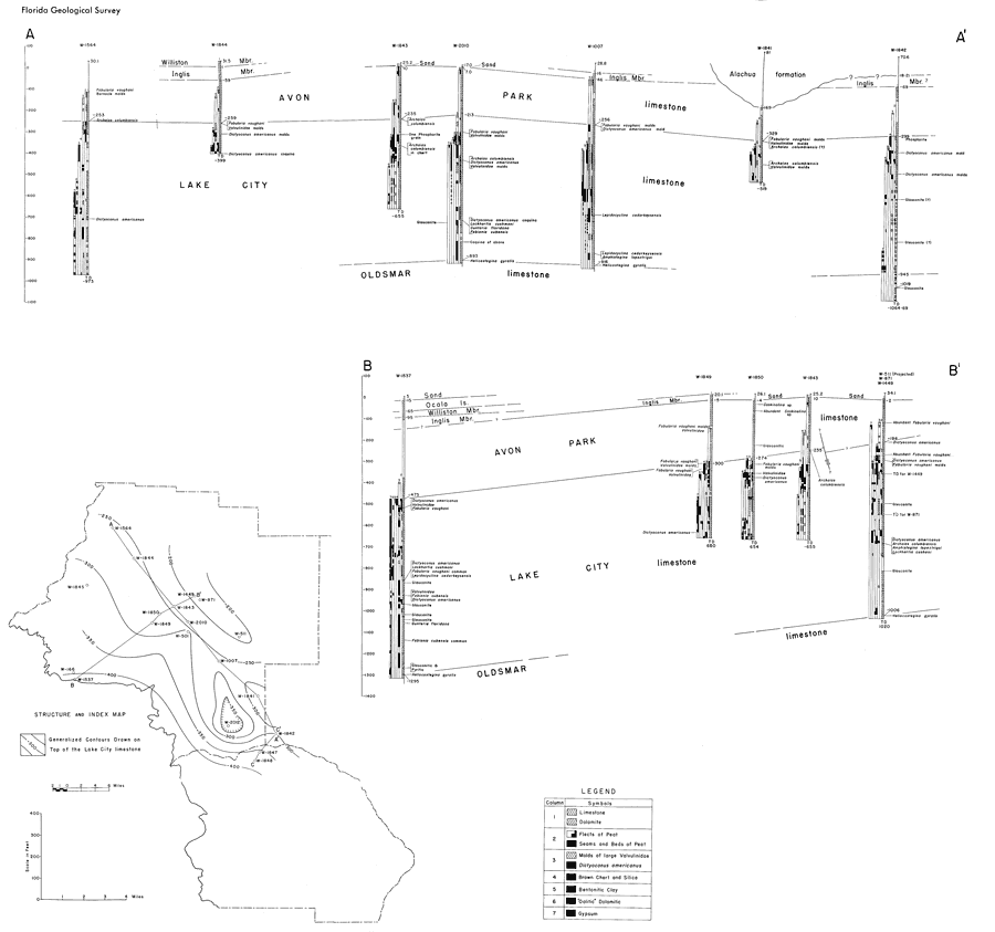
Description: This map from the Florida Geological Survey Bulletin number 33, shows the depth and profile of Lake City limestone in Citrus and Levy counties taken from well cores. Constituents of well core makeup are shown, including key fossil indicators of fauna zones, well numbers and total well depths, and the generalized contours drawn on top of the Lake City limestone formation
Place Names: 1950-1999, Citrus County, Levy County
ISO Topic Categories: boundaries, geoscientificInformation
Keywords: Geologic Sections through the Lake City Limestone in Citrus and Levy Counties, physical, political, kgeology, physical features, geological, county borders, boundaries, geoscientificInformation, Unknown,1951
Source: Robert O. Vernon, Geology of Citrus and Levy Counties, Florida (Tallahassee, FL: The Florida Geological Survey, 1951) 94
Map Credit: Courtesy the private collection of Roy Winkelman |
|
