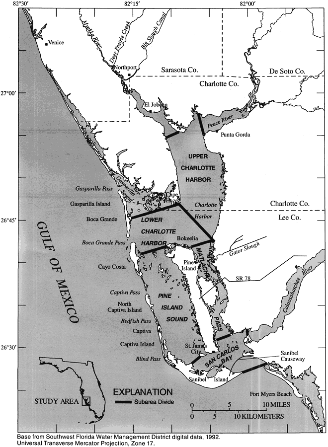
Description: This map from the U. S. Geological Survey Water Resources Investigation Report number 93-4153, Simulation of Tidal Flow, Circulation, and Flushing of the Charlotte Harbor Esturine System, shows the study area for the simulation of tidal-flow, circulation, and flushing of the Charlotte Harbor estuarine system. The Charlotte Harbor estuarine system is a series of shallow, interconnected waterbodies on the west-central coast of peninsular Florida and consists of Charlotte Harbor proper, Pine Island Sound, Matlacha Pass, San Carlos Bay, and the tidal reaches of the Myakka, Peace, and Caloosahatchee Rivers.
Place Names: 1950-1999, Pine Island Sound, Matlacha Pass, Charlotte Harbor, San Carlos Bay, Sanibel Island, Pine Island, Gasparilla Sound, Captiva Island, Punta Gorda, kcounties, khydrology
ISO Topic Categories: boundaries, geoscientificInformation, inlandWaters, oceans
Keywords: Charlotte Harbor Estuarine System and Subareas, physical, political, hydrological, khydrology, boundaries, geoscientificInformation, inlandWaters, oceans, Universal Transverse Mercator Projection, 1996
Source: Carl R. Goodwin, USGS Water Resources Investigations Report 93-4153 (Tallahassee, FL: U. S. Geological Survey, 1996) 46
Map Credit: Courtesy the University of South Florida Library |
|