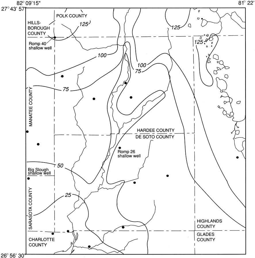
Description: This map from the U. S. Geological Survey Water Resources Investigation Report number 93-4158, Hydrology and Simulated Effects of Groundwater Withdrawals for Citrus Irrigation, Hardee and De Soto Counties, shows altitude of the water table in the surficial aquifer in Hardee and De Soto counties in September 1988. The contour intervals are 25 feet, and show the altitude of the water table in feet above sea level.
Place Names: 1950-1999, Hardee County, De Soto County
ISO Topic Categories: boundaries, geoscientificInformation
Keywords: Altitude of Water Table in Hardee and De Soto Counties, physical, political, hydrological, khydrological, kgroundwater, physical features, county borders, water table, boundaries, geoscientificInformation, Unknown,1988
Source: P. A. Metz, USGS Water Resources Investigations Report 93-4158 (Tallahassee, FL: U. S. Geological Survey, 1995) 12
Map Credit: Courtesy the University of South Florida Library |
|