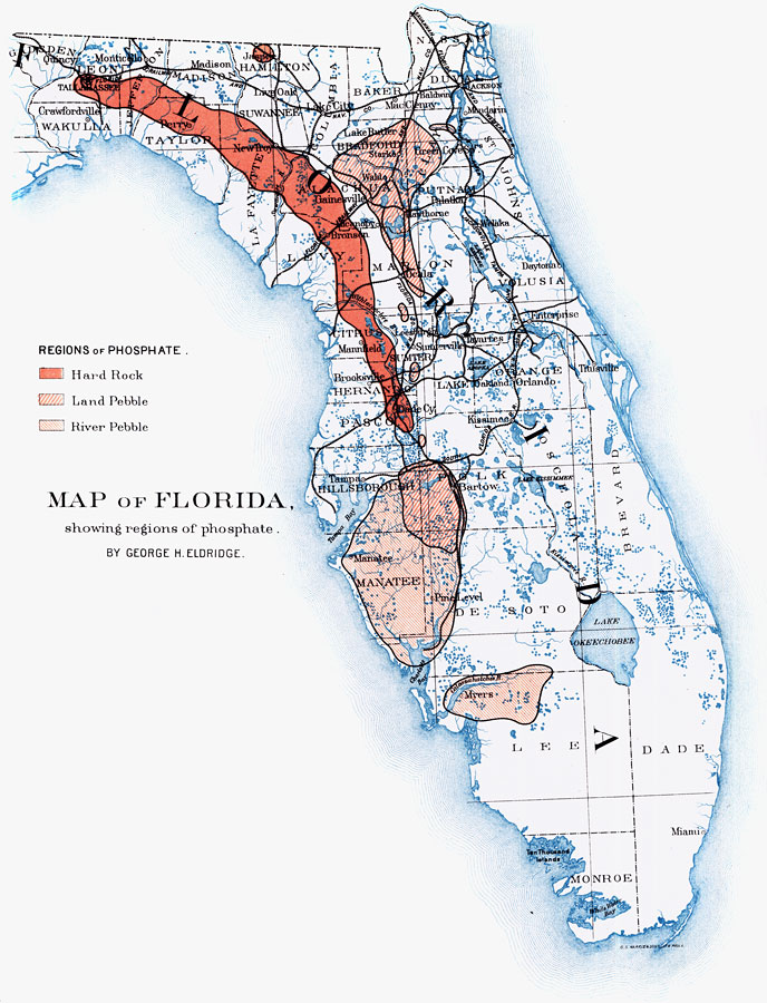
Description: A map of peninsular Florida from the Eleventh Census showing the phosphate fields of Florida and major railroad lines used for transport of minerals. The classifications of the phosphate regions are hard rock beds, land pebble, and river pebble.
Place Names: 1880-1899, Cape Canaveral, Florida, Jacksonville, Miami, Tampa, Tallahassee, Ocala
ISO Topic Categories: boundaries, economy, geoscientificInformation, inlandWaters, oceans, transportation
Keywords: Map of Florida Showing Regions of Phosphate, physical, political, statistical, transportation, kphosphate, kindustry, physical features, major political subdivisions, county borders, industry, railroads, boundaries, economy, geoscientificInformation, inlandWaters, oceans, transportation, Unknown,1892
Source: David T. Day and Robert P. Porter, Report on Mineral Industries Eleventh Census (Washington, DC: Government Printing Office, 1892) 688
Map Credit: Courtesy the private collection of Roy Winkelman |
|