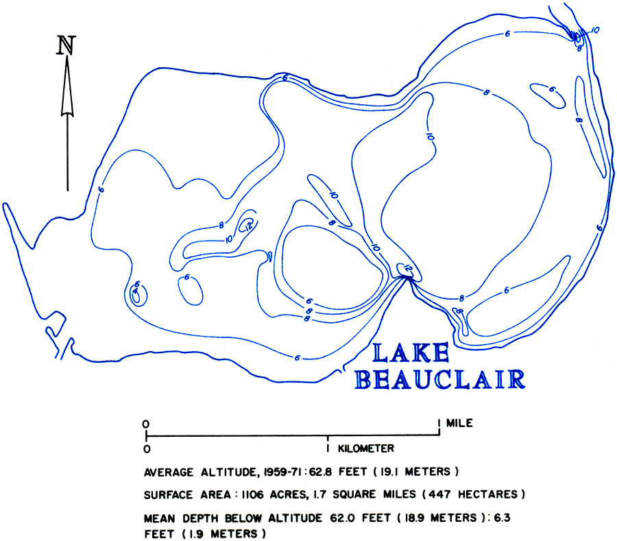
Description: This is a map showing Lake Beauclair in Lake County, current to 1974. It shows its average altitude, surface area and mean depth below altitude. "The level of Lakes Dora, Beauclair, and Carlton seems to more closely match the level of lakes Eustis and Harris after Dora Canal was enlarged about 1958." — Florida Bureau of Geology Please see the article Hydrology of the Oklawaha Lakes Area of Florida by P. W. Bush for more information.
Place Names: Lake, Lake Beauclair
ISO Topic Categories: geoscientificInformation, inlandWaters
Keywords: Hydrology of the Oklawaha Lakes Area of Florida- Lake Beauclair, physical, hydrological, geological, geoscientificInformation, inlandWaters, Unknown,1974
Source: U. S. Geological Survey, Bureau of Geology, Florida Department of Natural Resources, Florida Bureau of Geology (Tallahassee, FL: Florida Bureau of Geology, 1974)
Map Credit: Courtesy the University of South Florida Library |
|