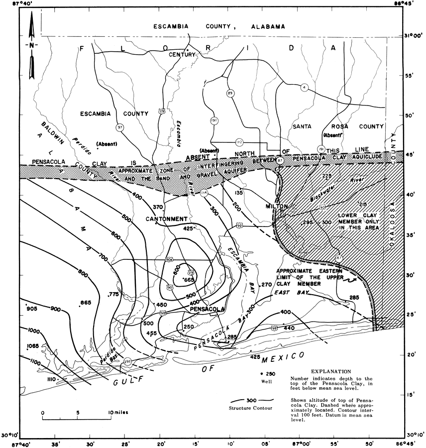
Description: This is a map showing the top of the Pensacola Clay in Escambia and Santa Rosa counties, current to 1967. "The contours represent the top of the Pensacola Clay in feet below sea level. The two beds of clay which compose this aquiclude lie immediately below the sand-and-gravel aquifer in the southern half of the two counties." — Florida Bureau of Geology Please see the article Ground-Water Features in Escambia and Santa Rosa Counties, Florida by Jack T. Barraclough for more information.
Place Names: 1950-1999, Escambia County, Santa Rosa County, Cantonment, Century, Pensacola, Gulf of Mexico, Blackwater River, Escambia Bay, Escambia River, Pensacola Bay, Perdido River, Milton
ISO Topic Categories: geoscientificInformation, inlandWaters, boundaries, oceans, transportation
Keywords: Ground-Water Features in Escambia and Santa Rosa Counties, Florida- Figure 7, physical, hydrological, political, transportation, geological, county borders, roads, geoscientificInformation, inlandWaters, boundaries, oceans, transportation, Unknown,1967
Source: U. S. Geological Survey, Bureau of Geology, Florida Department of Natural Resources, Florida Bureau of Geology (Tallahassee, FL: Florida Bureau of Geology, 1967)
Map Credit: Courtesy the University of South Florida Library |
|