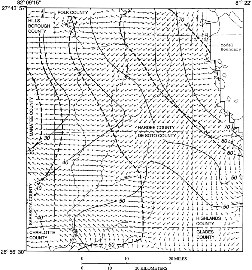
Description: This map from the U. S. Geological Survey Water Resources Investigation Report number 93-4158, Hydrology and Simulated Effects of Groundwater Withdrawals for Citrus Irrigation, Hardee and De Soto Counties, shows the interpolated and simulated potentiometric surfaces and direction of groundwater movement in the Upper Floridan aquifer system based on records from September 1989. Flow vectors show the direction of groundwater flow, and length of vector is proportional to velocity.
Place Names: 1950-1999, Hardee County, De Soto County
ISO Topic Categories: boundaries, geoscientificInformation
Keywords: Groundwater Movement in the Upper Floridan Aquifer System in Hardee and De Soto Counties, physical, political, hydrological, khydrological, kgroundwater, physical features, county borders, water table, boundaries, geoscientificInformation, Unknown,September 1989
Source: P. A. Metz, USGS Water Resources Investigations Report 93-4158 (Tallahassee, FL: U. S. Geological Survey, 1995) 59
Map Credit: Courtesy the University of South Florida Library |
|