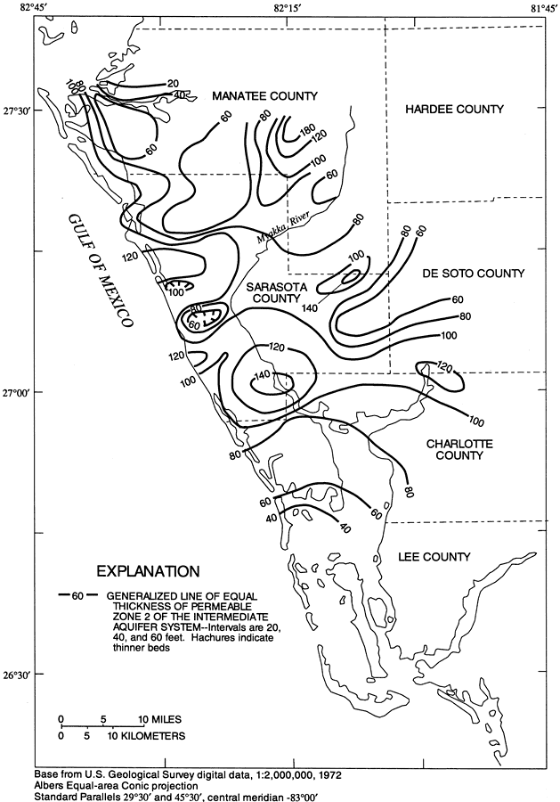
Description: This map from the U. S. Geological Survey Water Resources Investigation Report number 96-4063, Hydrology of the Surficial and Intermediate Aquifer Systems in Sarasota and Adjacent Counties, shows the generalized thickness in feet of permeable zone 2 of the intermediate aquifer system in Sarasota and adjacent counties. In the study area of the southwest region of Florida, the Upper Floridan aquifer is overlain by a surficial aquifer system and an intermediate aquifer system made up of 3 distinct permeable zones separated by confining units. The map scale is 1:2,000,000.
Place Names: 1950-1999, Sarasota County, Myakka River, Walton, South Venice, Englewood
ISO Topic Categories: boundaries, geoscientificInformation, inlandWaters
Keywords: Generalized Thickness of Permeable Zone 2 of the Intermediate Aquifer System in Southwest Florida, physical, political, hydrological, khydrology, kgroundwater, kaquifer, physical features, geological, county borders, water table, boundaries, geoscientificInformation, inlandWaters, Albers_Conical_Equal,1996
Source: G. L. Barr, USGS Water Resources Investigations Report 96-4063 (Tallahassee, FL: U. S. Geological Survey, 1996) 37
Map Credit: Courtesy the University of South Florida Library |
|