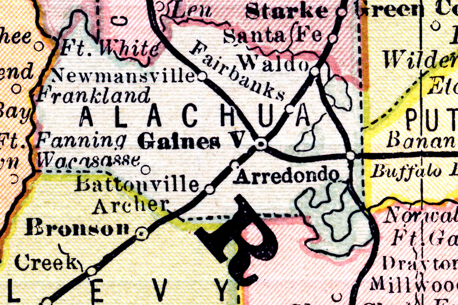
Description: This map shows the county of Alachua including the county seat (Gainesville) and transportation to the major cities current to1883.
Place Names: Alachua, Gainsville, Waldo , Arrendondo, Ft. Fanning, Frankland, Newnansville
ISO Topic Categories: boundaries, inlandWaters, transportation
Keywords: Alachua County, transportation, physical, political, physical features, county borders, railroads, boundaries, inlandWaters, transportation, Unknown,1883
Source: L.B. Folger, (Broadway, NY: Phillips & Hunt, 1883)
Map Credit: Courtesy the private collection of Roy Winkelman. |
|