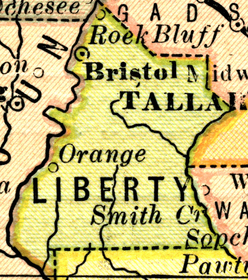
Description: A map of Liberty County showing county lines, the county seat (Brlistol), and railroads connecting the major cities current to 1883.
Place Names: Liberty, Bristol, Orange, Rock Bluff
ISO Topic Categories: boundaries
Keywords: Liberty County, physical, political, physical features, county borders, boundaries, Unknown,1883
Source: L.B. Folger, (Broadway, NY: Phillips & Hunt, 1883)
Map Credit: Courtesy the private collection of Roy Winkelman. |
|