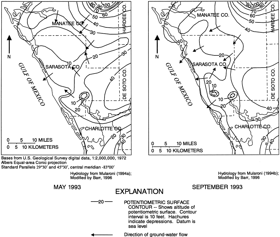
Description: These maps from the U. S. Geological Survey Water Resources Investigation Report number 96-4063, Hydrology of the Surficial and Intermediate Aquifer Systems in Sarasota and Adjacent Counties, show the altitude of potentiometric surface and direction of groundwater flow for May and September, 1993 within the intermediate aquifer system. The map scale is 1:2,000,000.
Place Names: 1950-1999, Sarasota County, Myakka River, Walton, South Venice, Englewood
ISO Topic Categories: boundaries, geoscientificInformation, inlandWaters
Keywords: Composite Potentiometric Surface of the Intermediate Aquifer System in Southwest Florida, physical, political, hydrological, khydrology, kgroundwater, kaquifer, physical features, geological, county borders, water table, boundaries, geoscientificInformation, inlandWaters, Albers_Conical_Equal,May and September 1993
Source: G. L. Barr, USGS Water Resources Investigations Report 96-4063 (Tallahassee, FL: U. S. Geological Survey, 1996) 69
Map Credit: Courtesy the University of South Florida Library |
|