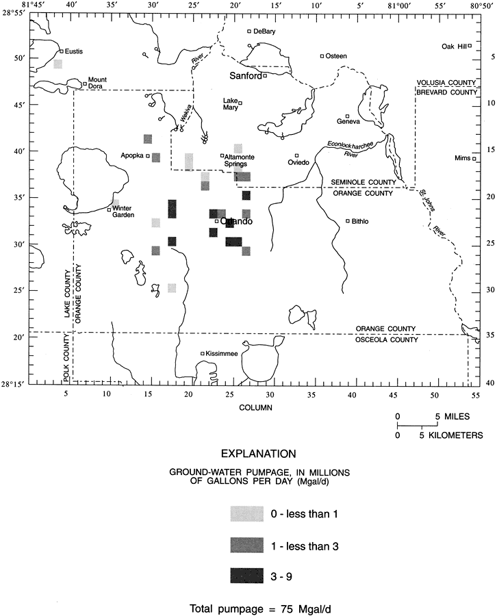
Description: This map from the U. S. Geological Survey Water Resources Investigation Report number 96-4181, Hydrogeologic Conditions and Simulation of Ground Water Flow in the Greater Orlando Metropolitan Area, shows the generalized distribution of average 1988 Lower Floridan aquifer pumpage measured in millions of gallons per day.
Place Names: 1950-1999, Orange County, Seminole County, Osceola County, Lake County, Volusia County, Brevard County, Greater Orlando Metropolitan Area, Orlando, Sanford,
ISO Topic Categories: boundaries, geoscientificInformation, inlandWaters
Keywords: Distribution of Average Pumpage of the Lower Floridan Aquifer in the Greater Orlando Metropolitan Area, physical, hydrological, political, khydrology, physical features, county borders, boundaries, geoscientificInformation, inlandWaters, Unknown,1988
Source: L. C. Murray, Jr. and Keith J. Halford, USGS Water Resources Investigations Report 96-4181 (Tallahassee, FL: U. S. Geological Survey, 1996) 39
Map Credit: Courtesy the University of South Florida Library |
|