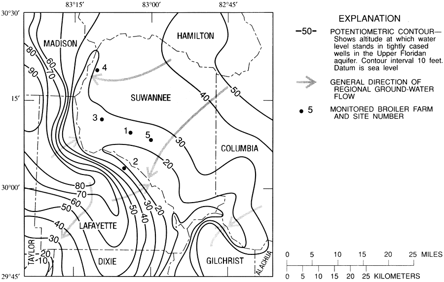
Description: This map from the U. S. Geological Survey Water Resources Investigation Report number 95-4064, Effects of Waste-Disposal Practices on Ground-Water Quality at Five Poultry Farms in North-Central Florida, shows the potentiometric-surface contours, in 10 foot intervals relative to sea level, and generalized direction of regional groundwater flow along the reach of the Suwannee River in the study area.
Place Names: 1950-1999, Suwannee County, Lafayette County, Madison County, Taylor County, Dixie County, Levy County, Gilchrist County, Columbia County, Union County, Bradford County, Ellaville,
ISO Topic Categories: boundaries, geoscientificInformation, inlandWaters
Keywords: Potentiometric Contours and Direction of Groundwater Flow in the Suwannee River Water Management District, physical, political, hydrological, khydrology, physical features, topographical, county borders, boundaries, geoscientificInformation, inlandWaters, Unknown,May 1990
Source: Hilda H. Hatzell, USGS Water Resources Investigations Report 95-4064 (Tallahassee, FL: U. S. Geological Survey, 1995) 5
Map Credit: Courtesy the University of South Florida Library |
|