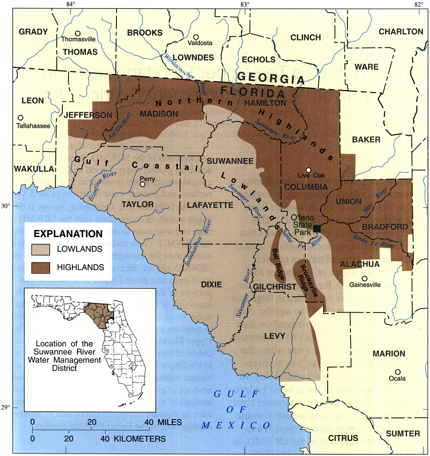
Description: This map from the U. S. Geological Survey Water Resources Investigation Report number 97-4283, Recharge Rates to the Upper Floridan Aquifer in the Suwannee River Water Management District, shows the physiographic areas of the Suwannee River Water Management District. The region lies within the Atlantic and Gulf Coastal Plain provinces, and consists primarily of the Northern Highlands and Gulf Coastal Lowlands physiographic divisions.
Place Names: 1950-1999, Suwannee River Water Management District,
ISO Topic Categories: boundaries, geoscientificInformation, inlandWaters
Keywords: Physiographic Areas of the Suwannee River Water Management District, physical, political, khydrological, kphysiography, physical features, geological, major political subdivisions, county borders, local jurisdictions, boundaries, geoscientificInformation, inlandWaters, Unknown,1998
Source: J. W. Grubbs, USGS Water Resources Investigations Report 97-4283 (Tallahassee, FL: U. S. Geological Survey, 1998) 2
Map Credit: Courtesy the University of South Florida Library |
|