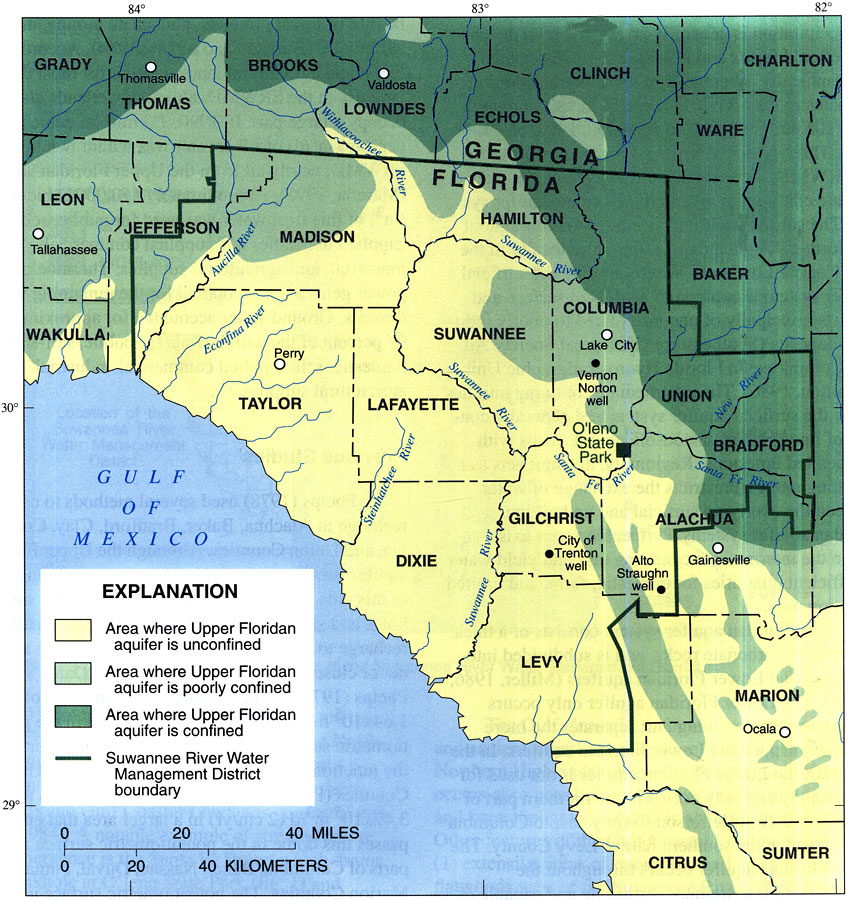
Description: This map from the U. S. Geological Survey Water Resources Investigation Report number 97-4283, Recharge Rates to the Upper Floridan Aquifer in the Suwannee River Water Management District, shows the areas in the District where the Upper Floridan aquifer is overlain by confining units and delineates confined, poorly confined, and unconfined areas of the aquifer system.
Place Names: 1950-1999, Suwannee River Water Management District,
ISO Topic Categories: boundaries, geoscientificInformation, inlandWaters
Keywords: Confinement of the Upper Floridan Aquifer in the Suwannee River Water Management District, physical, political, hydrological, physical features, geological, major political subdivisions, county borders, local jurisdictions, water table, boundaries, geoscientificInformation, inlandWaters, Unknown,1998
Source: J. W. Grubbs, USGS Water Resources Investigations Report 97-4283 (Tallahassee, FL: U. S. Geological Survey, 1998) 4
Map Credit: Courtesy the University of South Florida Library |
|