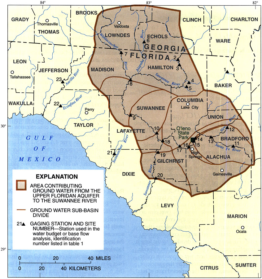
Description: This map from the U. S. Geological Survey Water Resources Investigation Report number 97-4283, Recharge Rates to the Upper Floridan Aquifer in the Suwannee River Water Management District, shows the locations of gaging stations used in water budget or base flow analysis. The map also shows the area contributing groundwater from the Upper Floridan aquifer to the Suwannee River, including groundwater sub-basins.
Place Names: 1950-1999, Suwannee River Water Management District,
ISO Topic Categories: boundaries, geoscientificInformation, inlandWaters
Keywords: Area Contributing Groundwater from the Floridan Aquifer to the Suwannee River, physical, political, hydrological, khydrological, physical features, geological, major political subdivisions, county borders, drainage basins, boundaries, geoscientificInformation, inlandWaters, Unknown,1998
Source: J. W. Grubbs, USGS Water Resources Investigations Report 97-4283 (Tallahassee, FL: U. S. Geological Survey, 1998) 10
Map Credit: Courtesy the University of South Florida Library |
|