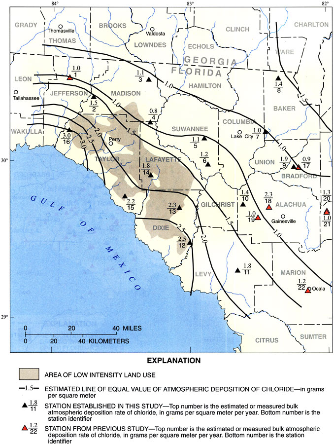
Description: This map from the U. S. Geological Survey Water Resources Investigation Report number 97-4283, Recharge Rates to the Upper Floridan Aquifer in the Suwannee River Water Management District, shows areas of low intensity land use, and areas of equal value atmospheric deposition of chloride measured in grams per square meter per year.
Place Names: 1950-1999, Suwannee River Water Management District,
ISO Topic Categories: boundaries, geoscientificInformation, inlandWaters
Keywords: Land Use and Atmospheric Deposition of Chloride in the Suwannee River Water Management District, physical, political, hydrological, khydrological, physical features, geological, major political subdivisions, county borders, boundaries, geoscientificInformation, inlandWaters, Unknown,1998
Source: J. W. Grubbs, USGS Water Resources Investigations Report 97-4283 (Tallahassee, FL: U. S. Geological Survey, 1998) 12
Map Credit: Courtesy the University of South Florida Library |
|