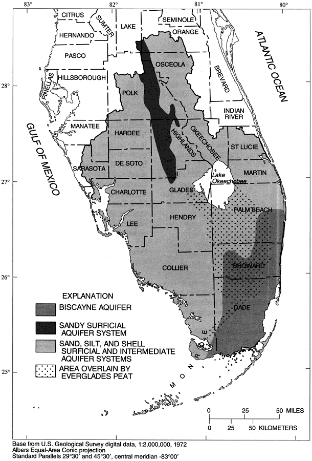
Description: This map from the U. S. Geological Survey Water Resources Investigation Report number 96-4177, Water-Quality Assessment of Southern Florida, shows the aquifer systems in southern Florida and the extent of peat in the Everglades region. The aquifer systems shown are the Biscayne Aquifer, sandy surficial aquifer, and sand, silt, and shell surficial and intermediate aquifer systems. The map scale is 1:2,000,000.
Place Names: 1950-1999, Southern Florida National Water Quality Assessment Unit, Peace River, Myakka River, Kissimmee River, Lake Okeechobee, Everglades Agricultural Area, East Coast Urban Area, Everglades, Big Cypress, Caloosahatchee River, St. Lucie River,
ISO Topic Categories: boundaries, geoscientificInformation, inlandWaters, oceans
Keywords: Aquifer Systems and Extent of Peat in Southern Florida, physical, political, hydrological, aquifer, peat, khydrological, physical features, geological, local jurisdictions, county borders, boundaries, geoscientificInformation, inlandWaters, oceans, Albers_Conical_Equal,1996
Source: K. H. Haag, R. L. Miller, L. A. Bradner, and D. S. McCulloch , USGS Water Resources Investigations Report 96-4177 (Tallahassee, FL: U. S. Geological Survey, 1996) 20
Map Credit: Courtesy the University of South Florida Library |
|