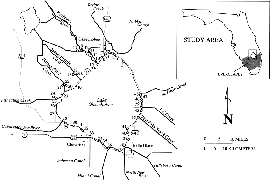
Description: This map from the U. S. Geological Survey Water Resources Investigation Report number 97-4011, An Optimized Network for Phosphorus Load Monitoring for Lake Okeechobee, shows the 48 inflow and outflow points for Lake Okeechobee where surface water drainage can enter or leave the lake. Most of these are controlled by structures such as gates, pumps, locks, or culverts. Only discharge from Fisheating Creek at number 25 on the map is uncontrolled inflow.
Place Names: 1950-1999, Lake Okeechobee, Kissimmee River, Taylor Creek, Nubbin Slough, St. Lucie Canal, L-8 Canal, West Palm Beach Canal, Belle Glade, Hillsborough Canal, North New River Canal, Miami Canal, Induscan Canal, Clewston, Caloosahatchee River, Fisheating Creek, Harney Pond Canal, Indian Prairie Canal, Okeechobee
ISO Topic Categories: geoscientificInformation, inlandWaters
Keywords: Inflow and Outflow Points for Lake Okeechobee, physical, transportation, hydrological, surface water, khydrological, physical features, roads, geoscientificInformation, inlandWaters, Unknown,1997
Source: W. Scott Gain, USGS Water Resources Investigations Report 97-4011 (Tallahassee, FL: U. S. Geological Survey, 1997) 3
Map Credit: Courtesy the University of South Florida Library |
|