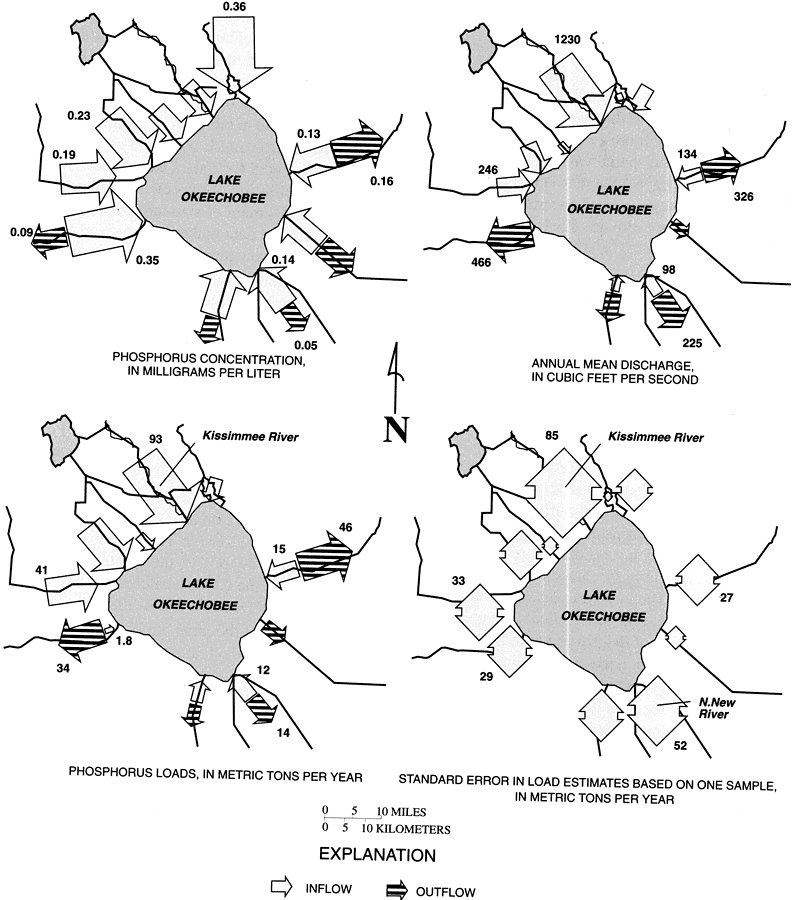
Description: These maps from the U. S. Geological Survey Water Resources Investigation Report number 97-4011, An Optimized Network for Phosphorus Load Monitoring for Lake Okeechobee, show the spatial distribution of average phosphorus concentration in milligrams per liter, annual mean discharge in cubic feet per second, phosphorus loads in metric tons per year, and standard error in load estimates based on one sample, in metric tons per year, for Lake Okeechobee averaged over the period 1982 to 1991. The maps also show the relationship between inflow and outflow.
Place Names: 1950-1999, Lake Okeechobee, Kissimmee River, Taylor Creek, Nubbin Slough, St. Lucie Canal, L-8 Canal, West Palm Beach Canal, Belle Glade, Hillsborough Canal, North New River Canal, Miami Canal, Induscan Canal, Clewston, Caloosahatchee River, Fisheating Creek, Harney Pond Canal, Indian Prairie Canal, Okeechobee
ISO Topic Categories: geoscientificInformation, inlandWaters
Keywords: Spatial Distribution of Phosphorus Concentrations, Discharge, Loads, and Standard Error in Load Estimates for Lake Okeechobee, physical, hydrological, khydrological, physical features, geoscientificInformation, inlandWaters, Unknown,1982 to 1991
Source: W. Scott Gain, USGS Water Resources Investigations Report 97-4011 (Tallahassee, FL: U. S. Geological Survey, 1997) 16
Map Credit: Courtesy the University of South Florida Library |
|