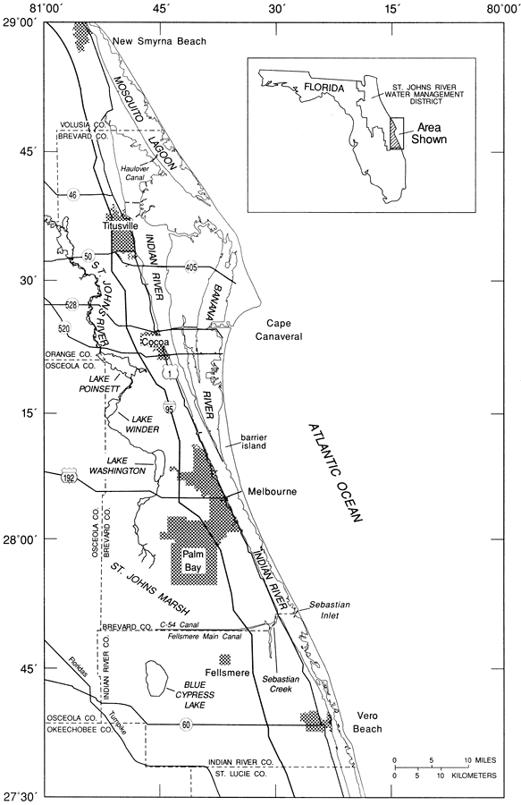
Description: This map from the U. S. Geological Survey Water Resources Investigation Report number 97-4011, Rainfall and Freshwater Discharge in the Indian River Basin, shows the location of the study basin, including major municipalities, roads, barrier islands, streams, lakes, and waterways.
Place Names: 1950-1999,
ISO Topic Categories: boundaries, geoscientificInformation, inlandWaters, oceans
Keywords: Location of the Indian River Basin within the St. Johns River Water Management District, physical, political, transportation, hydrological, khydrological, physical features, county borders, local jurisdictions, roads, boundaries, geoscientificInformation, inlandWaters, oceans, Unknown,1989 to 1991
Source: Lee Knowles, Jr. , USGS Water Resources Investigations Report 94-4193 (Tallahassee, FL: U. S. Geological Survey, 1995) 2
Map Credit: Courtesy the University of South Florida Library |
|