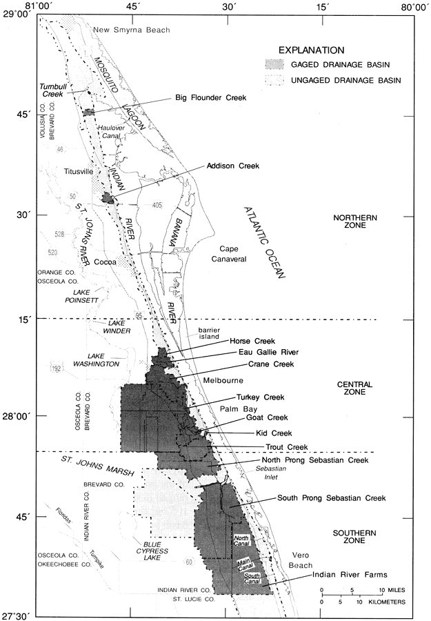
Description: This map from the U. S. Geological Survey Water Resources Investigation Report number 97-4011, Rainfall and Freshwater Discharge in the Indian River Basin, shows the location of gaged and ungaged drainage basins within the Indian River Basin, including Turnbull Creek, Big Flounder Creek, Addison Creek, Horse Creek, Eau Gallie Creek, Crane Creek, Turkey Creek, Goat Creek, Kid Creek, Trout Creek, Sebastian Creek, Indian River Farms, and three canals near Vero Beach.
Place Names: 1950-1999, Titusville, Cape Canaveral, Melbourne, Sebastian Inlet, Vero Beach, Palm Bay, Lake Washington, Cocoa, Mosquito Lagoon, Banana River, Indian River, Brevard County, Indian River County,
ISO Topic Categories: boundaries, geoscientificInformation, inlandWaters, oceans
Keywords: Study Basins within the Indian River Basin, physical, political, hydrological, khydrological, physical features, county borders, local jurisdictions, drainage basins, boundaries, geoscientificInformation, inlandWaters, oceans, Unknown,1989 to 1991
Source: Lee Knowles, Jr. , USGS Water Resources Investigations Report 94-4193 (Tallahassee, FL: U. S. Geological Survey, 1995) 10
Map Credit: Courtesy the University of South Florida Library |
|