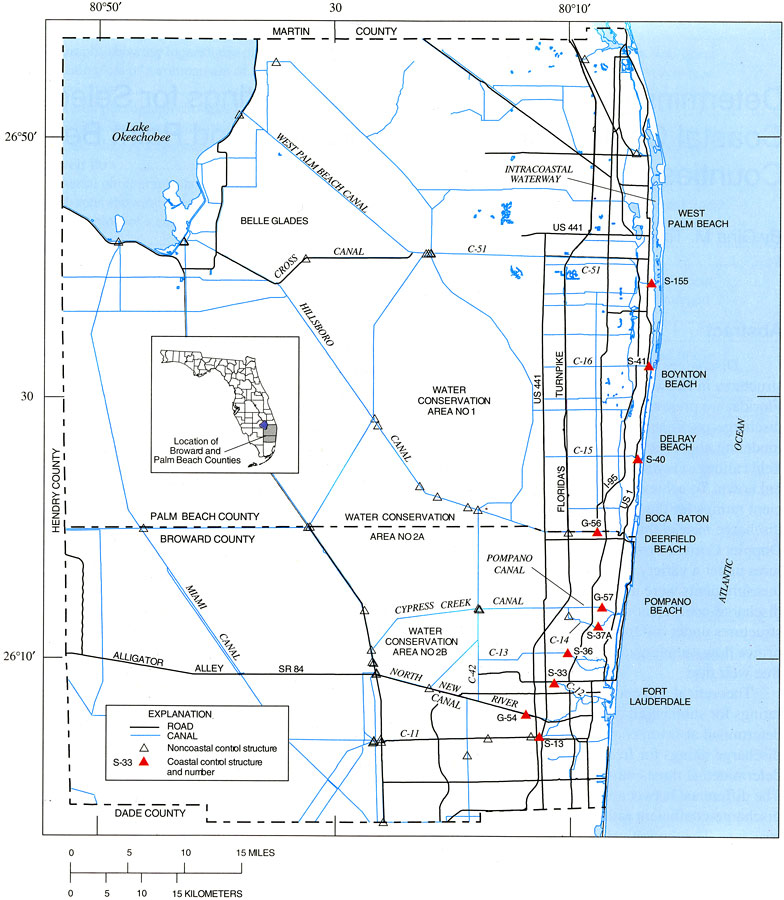
Description: This map from the U. S. Geological Survey Water Resources Investigation Report number 98-4007 shows major roads, canals, and hydraulic control structures in Broward and Palm Beach counties. The map shows a portion of the extensive canal and levee system constructed over the last century in southern Florida built for purposes of draining wetlands and water management operations such as flood control and drought mitigation. The coastal control structures are significant report in studying saltwater intrusion in the Biscane aquifer.
Place Names: 1950-1999, Broward County, Palm Beach County, Lake Okeechobee, Intracoastal Waterway, Belle Glade, Boca Raton, Boynton Beach, counties, Fort Lauderdale
ISO Topic Categories: boundaries, inlandWaters, oceans
Keywords: Hydraulic Control Structures in Broward and Palm Beach Counties, physical, political, hydrological, khydrological, kcanal, physical features, county borders, drainage basins, boundaries, inlandWaters, oceans, Unknown,1998
Source: Gina M. Tillis and Eric D. Swain, USGS Water Resources Investigations Report 98-4007 (Tallahassee, FL: U. S. Geological Survey, 1998) 2
Map Credit: Courtesy the University of South Florida Library |
|