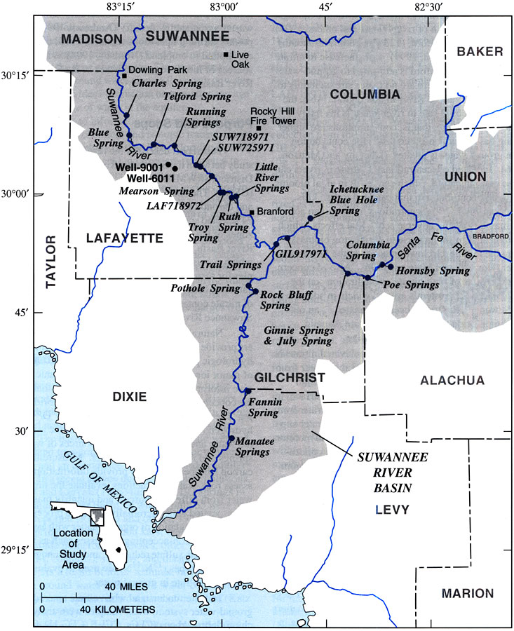
Description: This map from the U. S. Geological Survey Water Resources Investigation Report number 99-4252, Source and Chronology of Nitrate Contamination in Spring Waters, Suwannee River Basin, shows the location of major springs and well sites used in the study along the Suwannee River and Santa Fe River.
Place Names: 1950-1999, Suwannee County, Columbia County, Lafayette County, Union County, Alachua County, Gilchrist County, Dixie County, Levy County, Suwannee River Basin
ISO Topic Categories: boundaries, geoscientificInformation, inlandWaters
Keywords: Springs of the Lower Suwannee River Basin, physical, political, hydrological, khydrological, ksprings, physical features, county borders, local jurisdictions, drainage basins, boundaries, geoscientificInformation, inlandWaters, Unknown,1999
Source: B. G. Katz, H. D. Hornsby, J. F. Bohlke, and M. F. Mokray, USGS Water Resources Investigations Report 99-4252 (Tallahassee, FL: U. S. Geological Survey, 1999) 3
Map Credit: Courtesy the University of South Florida Library |
|