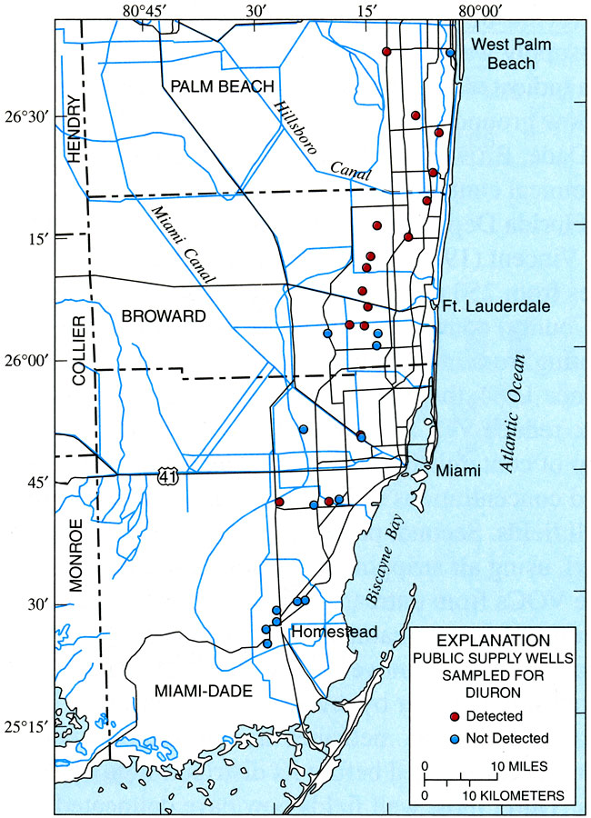
Description: This map from the U. S. Geological Survey Open-File Report number 2004-1438, Quality of Ground Water in the Biscayne Aquifer, shows the regional pattern of occurrence of the pesticide diuron detected in samples from public-supply wells in the Biscayne aquifer.
Place Names: 1950-1999, Palm Beach County, Broward County, Miami Dade County, West Palm Beach, Ft. Lauderdale, Miami, Homestead, Biscayne Bay
ISO Topic Categories: boundaries, geoscientificInformation, inlandWaters, oceans
Keywords: Occurrence of Diuron from Public-Supply Wells in the Biscayne Aquifer, physical, political, hydrological, khydrological, kpollution, physical features, county borders, drainage basins, boundaries, geoscientificInformation, inlandWaters, oceans, Unknown,1996 to 1998
Source: A. Bradner, B. F. McPherson, R. L. Miller, G. Kish, and B. Bernard, USGS Open-File Report 2004-1438 (Reston, VA: U. S. Geological Survey, 2005) 13
Map Credit: Courtesy the University of South Florida Library |
|