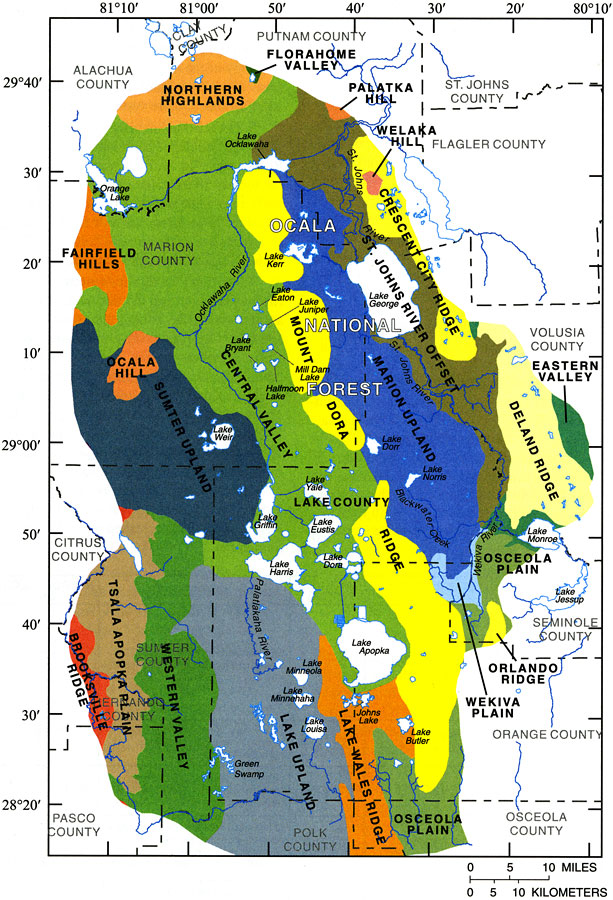
Description: This map from the U. S. Geological Survey Water Resources Investigation Report number 01-4008, Ground-Water Quality of the Surficial Aquifer System and the Upper Floridan Aquifer, Ocala National Forest and Lake County, 1990-99, shows the physiography of the area based on works of W. A. White, 1970. The area is located in the Central Highlands topographical division, and contains three basic physiographic land forms— ridges, valleys, and uplands. The predominant features include parts of the Mount Dora and Lake Wales Ridges, which run parallel and are separated by the Central Valley. Also found in the region are the St. Johns River Offset, and the Marion, Sumter, and Lake Uplands.
Place Names: 1950-1999, Ocala National Forest, Lake County, Marion County, Lake George
ISO Topic Categories: boundaries, geoscientificInformation, inlandWaters
Keywords: Physiography of the Ocala National Forest and Lake County Region, physical, political, hydrological, khydrological, kwater quality, physical features, county borders, local jurisdictions, boundaries, geoscientificInformation, inlandWaters, Unknown,1990 to 1999
Source: J. C. Adamski and L. Knowles, Jr., USGS Water Resources Investigations Report 01-4008 (Tallahassee, FL: U. S. Geological Survey, 2001) 5
Map Credit: Courtesy the University of South Florida Library |
|