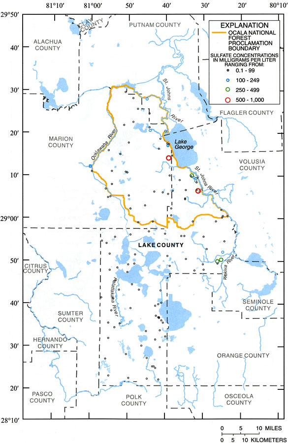
Description: This map from the U. S. Geological Survey Water Resources Investigation Report number 01-4008, Ground-Water Quality of the Surficial Aquifer System and the Upper Floridan Aquifer, Ocala National Forest and Lake County, 1990-99, shows the concentrations of sulfate measured in milligrams per Liter in samples from wells tapping the Upper Floridan aquifer system in the study area.
Place Names: 1950-1999, Ocala National Forest, Lake County, Marion County, Lake George
ISO Topic Categories: boundaries, geoscientificInformation, inlandWaters
Keywords: Concentrations of Sulfate in Groundwater from the Upper Floridan Aquifer of Ocala National Forest and Lake County, physical, political, hydrological, khydrological, kwater quality, physical features, county borders, local jurisdictions, boundaries, geoscientificInformation, inlandWaters, Unknown,1990 to 1999
Source: J. C. Adamski and L. Knowles, Jr., USGS Water Resources Investigations Report 01-4008 (Tallahassee, FL: U. S. Geological Survey, 2001) 25
Map Credit: Courtesy the University of South Florida Library |
|