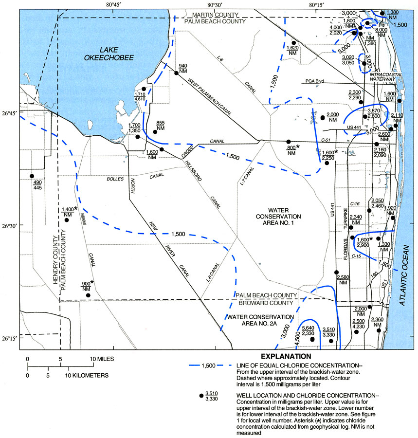
Description: This map from the U. S. Geological Survey Water Resources Investigation Report number 99-4061, Hydrology and the Distribution of Salinity in the Floridan Aquifer System, Palm Beach County, shows concentrations of chloride in milligrams per liter found in ground water from the upper and lower intervals of the brackish-water zone in Palm Beach and northern Broward counties. Chloride concentrations are shown next to the well sites, with the upper value being for the upper interval of the brackish-water zone, and the lower value for the lower interval of the zone. Also shown on the map are well sites used in the study and the canal system in the county.
Place Names: Palm Beach, Intracoastal Waterway, Lake Okeechobee
ISO Topic Categories: boundaries, geoscientificInformation, inlandWaters, oceans
Keywords: Chloride Concentrations in Groundwater in Palm Beach County, physical, political, transportation, hydrological, khydrological, physical features, geological, county borders, roads, boundaries, geoscientificInformation, inlandWaters, oceans, Unknown,2000
Source: R. S. Reese and S. J. Memberg, USGS Water Resources Investigations Report 99-4061 (Tallahassee, FL: U. S. Geological Survey, 2000) 31
Map Credit: Courtesy the University of South Florida Library |
|