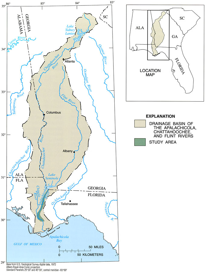
Description: This map from the U. S. Geological Survey Professional Paper number 1594, Aquatic Habitats in Relation to River Flow in the Apalachicola River Floodplain, shows the Apalachicola drainage basin from Lake Seminole to the Apalachicola Bay in Florida and contributing watersheds from the Chattahoochee and Flint rivers in Georgia and Alabama. The map also shows the Choctawhatchee, Ochlockonee, and portions of the Suwannee rivers in Florida.
Place Names: 1950-1999, Alabama, Georgia, Chattahoochee River, Flint River, Apalachicola Bay, Gulf of Mexico, Tallahassee
ISO Topic Categories: geoscientificInformation, inlandWaters, boundaries
Keywords: Drainage Basin of the Apalachicola River, physical, hydrological, khydrological, political, physical features, major political subdivisions, currents, drainage basins, geoscientificInformation, inlandWaters, boundaries, Albers_Conical_Equal,1998
Source: H. M. Light, M. R. Darst, and J. W. Grubbs, USGS Professional Paper 1594 (Tallahassee, FL: U. S. Geological Survey, 1998) 4
Map Credit: Courtesy the University of South Florida Library |
|