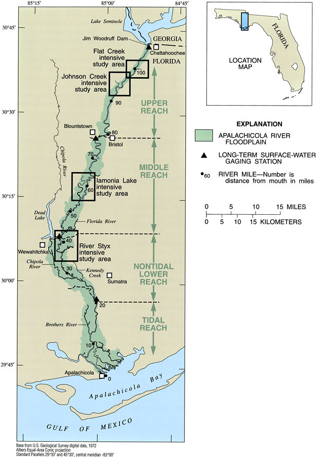
Description: This map from the U. S. Geological Survey Professional Paper number 1594, Aquatic Habitats in Relation to River Flow in the Apalachicola River Floodplain, shows the floodplain of the Apalachicola River, and includes river-milage points between its discharge into Apalachicola Bay to the Jim Woodruff Dam on the Florida-Georgia state line. Major reaches of the Apalachicola River and locations of intensive study areas are shown. The reach boundaries are based on physiographic and geomorphic differences.
Place Names: 1950-1999, Jim Woodruff Dam, Chattahoochee, Blountstown, Bristol, Dead Lake, Wewahitchka, Sumatra, Apalachicola, Apalachicola Bay, Gulf of Mexico
ISO Topic Categories: geoscientificInformation, inlandWaters, boundaries
Keywords: Floodplain of the Apalachicola River, physical, hydrological, khydrological, kphysiologic, physical features, currents, drainage basins, geoscientificInformation, inlandWaters, boundaries, Albers_Conical_Equal,1998
Source: H. M. Light, M. R. Darst, and J. W. Grubbs, USGS Professional Paper 1594 (Tallahassee, FL: U. S. Geological Survey, 1998) 6
Map Credit: Courtesy the University of South Florida Library |
|