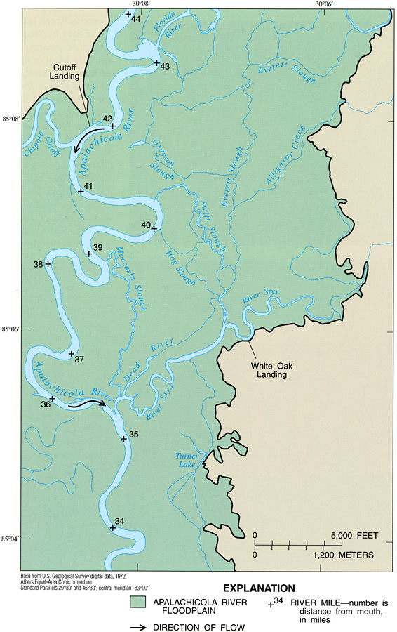
Description: This map from the U. S. Geological Survey Professional Paper number 1594, Aquatic Habitats in Relation to River Flow in the Apalachicola River Floodplain, shows the Apalachicola River floodplain of the River Styx intensive study area between Gulf and Liberty Counties. This section of the river is in its nontidal lower reach, and is typified by broad meanders, evidence of remnant stream courses such the numerous sloughs, and its relatively broad floodplain. River-mile markers are shown as distance from the river discharge into the Apalachicola Bay on the Gulf of Mexico. Smaller, contributing streams and sloughs are shown, including the Chipola Cutoff, Florida River, Alligator Creek, Everett Slough, Swift Slough, Moccasin Slough, Dead River, Turner Lake, and River Styx.
Place Names: 1950-1999, Gulf County, Liberty County, Cutoff Landing, White Oak Landing, River Styx, Dead River, Florida River, Chipola Cutoff
ISO Topic Categories: geoscientificInformation, inlandWaters, boundaries
Keywords: River Styx Intensive Study Area, physical, hydrological, khydrological, physical features, currents, drainage basins, geoscientificInformation, inlandWaters, boundaries, Albers_Conical_Equal,1998
Source: H. M. Light, M. R. Darst, and J. W. Grubbs, USGS Professional Paper 1594 (Tallahassee, FL: U. S. Geological Survey, 1998) 35
Map Credit: Courtesy the University of South Florida Library |
|