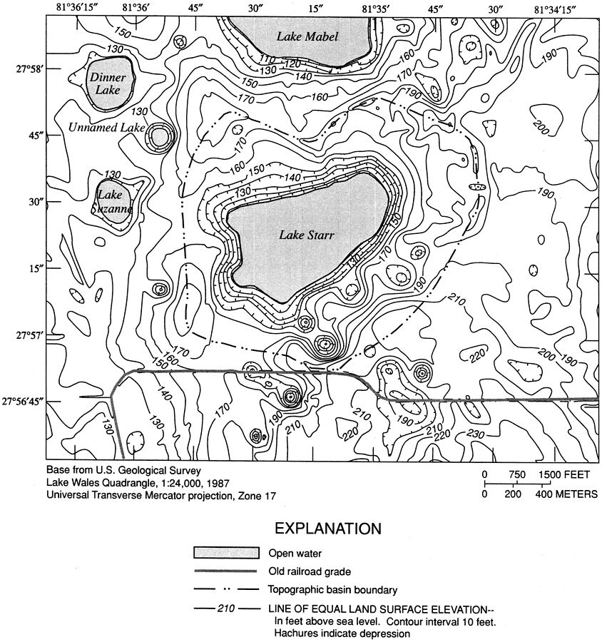
Description: This map from the U. S. Geological Survey Water Resources Investigation Report number 00-4030 shows the topography and topographic basin boundary of Lake Starr in Polk County. Lake Starr, a 134-acre seepage lake of multiple sinkhole origin on the Lake Wales Ridge of central Florida, is typical of karst terrain lake hydrology in Florida, which is complex in its integral connection between surface and ground water. The contours are in feet above sea level, with hachures indicating depression.
Place Names: Polk, Lake Wales
ISO Topic Categories: elevation, geoscientificInformation, inlandWaters
Keywords: Topography of Lake Starr Basin, physical, hydrological, khydrological,ktopographical, physical features, topographical, water depths, water table, elevation, geoscientificInformation, inlandWaters, Universal Transverse Mercator, 2000
Source: Amy Swancar, T. M. Lee, and T. M. O'Hare, USGS Water Resources Investigations Report 00-4030 (Tallahassee, FL: U. S. Geological Survey, 2000) 6
Map Credit: Courtesy the University of South Florida Library |
|