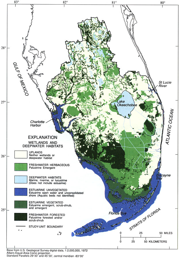
Description: This map from the U. S. Geological Survey Circular 1134, The South Florida Environment, shows the various wetlands and deepwater habitats of south Florida. The categories include uplands, which are neither wetlands or deepwater habitats, freshwater herbaceous palustrine emergent, deepwater habitats including marine, riverine, or lucustrine, estuarine unvegetated, estuarine vegetated, and freshwater forested.
Place Names: 1950-1999, Gulf of Mexico, Charlotte Harbor, Ten Thousand Islands, Whitewater Bay, Florida Bay, Biscayne Bay, Straits of Florida, Everglades, Atlantic Ocean, St. Lucie River, Lake Okeechobee, Kissimmee River, Myakka River, Peace River, Caloosahatchee River
ISO Topic Categories: boundaries, geoscientificInformation, inlandWaters, oceans, biota, environment
Keywords: Wetlands and Deepwater Habitats of South Florida, physical, political, statistical, hydrological, kestuarine, physical features, local jurisdictions, vegetation, boundaries, geoscientificInformation, inlandWaters, oceans, biota, environment, Albers_Conical_Equal,1996
Source: B. F. McPherson and R. Halley, USGS Circular 1134 (Washington, DC: U. S. Government Printing Office, 1996) 14
Map Credit: Courtesy the University of South Florida Library |
|